Typhoon Rosal Exits PAR: Rain Outlook for Cebu and Davao
Typhoon Rosal has left the Philippine Area of Responsibility. PAGASA still sees scattered rain in parts of the Visayas and Mindanao; here is what it means for travel.
In this article
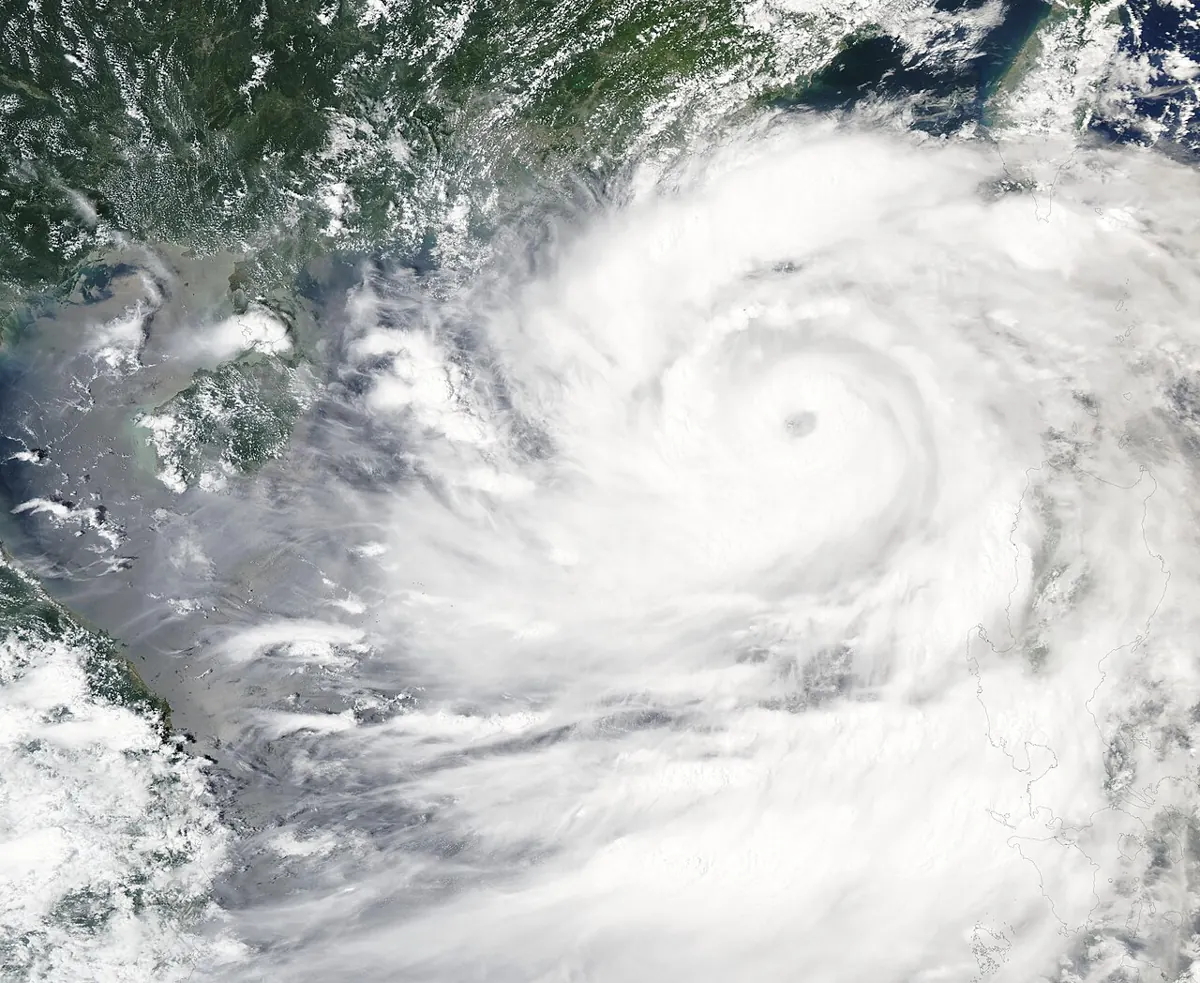
Typhoon Rosal exits PAR, the Philippine Area of Responsibility, according to PAGASA's 11 a.m. bulletin on Saturday, October 24, 2026. The storm, known internationally as Champi, never made landfall in the Philippines and is heading toward the East China Sea. Cebu and Davao were not directly hit, but scattered rain is still possible.
Where Rosal is now
GMA News reported that at 11 a.m. the center was about 525 kilometers north-northeast of Itbayat, Batanes, outside PAR, moving east-northeast at 20 kph. Maximum sustained winds were 120 kph near the center with gusts up to 150 kph. No tropical cyclone wind signal was in effect in that bulletin.
Philstar's earlier report, based on PAGASA's 4 p.m. Friday position, said Signal No. 2 had covered Batanes and Signal No. 1 had covered northern Cagayan, including the Babuyan Islands, northern Ilocos Norte and northern Apayao. Batanes took the brunt of the storm.
What it meant for travel
Philstar reported that the Civil Aviation Authority of the Philippines temporarily closed Basco Airport in Batanes, cancelling two Clark–Basco flights that affected 148 passengers. CAAP advised affected passengers to contact their airlines for updates and rebooking.
Rain and wind outlook for the Visayas and Mindanao
PAGASA's final advisory, as quoted by Philstar, said scattered rain and thunderstorms are still possible within 24 hours over parts of the Visayas, Cordillera, Zamboanga Peninsula, Palawan, Mindanao and several northern provinces.
GMA News added that strong to gale-force gusts may affect exposed coastal and upland areas, including Romblon, Capiz, Iloilo and Negros Occidental in the Visayas, along with several Luzon areas. Cebu and Davao were not named in the reports we reviewed, but conditions can change quickly.
Rappler's October 24 update also pointed to scattered rain from the trough and the intertropical convergence zone (ITCZ), a belt of showers near the equator.
Practical tips for Cebu and Davao travellers
- Check the live weather widgets and forecasts before island hopping or mountain trips.
- Ferries and small boats can be delayed by rough seas; confirm with operators.
- Learn what each warning means with our guide to PAGASA wind signals.
- Planning a trip? See the best time to visit Cebu and Davao.
What happens next
Rappler reported that, as of the afternoon of October 24, no new low pressure areas or tropical cyclones were being monitored inside or outside PAR. Forecasts can change, so follow PAGASA's official bulletins.
Sources
- GMA News: Typhoon Rosal exits PAR — PAGASA
- Philstar: Typhoon Rosal set to exit PAR today
- Rappler: Typhoon Rosal exits PAR; ITCZ bringing scattered rain
Frequently Asked Questions
Did Typhoon Rosal hit Cebu or Davao?
No. Reports say it never made landfall in the Philippines and its strongest effects were in Batanes and northern Luzon.
Is there a new storm coming?
As of the afternoon of October 24, Rappler reported no new low pressure area or tropical cyclone being monitored.
Is it safe to travel to Cebu or Davao now?
Scattered rain is possible in parts of the Visayas and Mindanao. Check PAGASA and your carrier before travelling.