Super Typhoon Rosal (Champi): Will It Affect Cebu and Davao?
Super Typhoon Rosal entered the Philippine area on 20 October 2026. PAGASA does not expect landfall, and no signals are up for the Visayas or Mindanao yet.
In this article
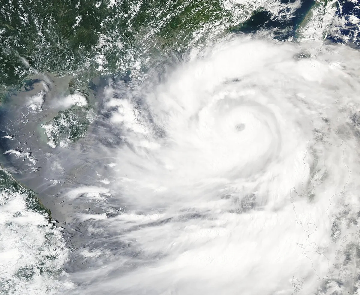
Super Typhoon Rosal, known internationally as Champi, entered the Philippine Area of Responsibility (PAR) on the morning of Tuesday, 20 October 2026. According to PAGASA bulletins reported by GMA News, Rappler and The Manila Times, the storm is forecast to stay over the Philippine Sea and is not expected to make landfall. No wind signals have been raised for Cebu, Davao or anywhere else in the Visayas or Mindanao.
What is Super Typhoon Rosal doing right now?
GMA News reported that Rosal crossed into the PAR at about 10:40 a.m. on 20 October. In its 5 p.m. bulletin, PAGASA put the maximum sustained winds near the centre at 195 km/h, with gusts of up to 240 km/h, as reported by The Manila Times. Earlier in the day, while the storm was still outside the PAR, the figures were slightly lower at 185 km/h and 230 km/h.
The Manila Times said the eye was about 1,270 km east of Central Luzon at 4 p.m. and moving west-northwest at 25 km/h. It is the country's 18th tropical cyclone of 2026, according to the reports.
Where is the storm headed?
PAGASA's forecast, as relayed by GMA News, has Rosal moving west-northwest until Wednesday, 21 October, then northwestward until Friday morning, 23 October. It then turns north-northwestward to northward and is expected to leave the PAR by Friday evening or early Saturday, 24 October.
| Date | Expected development (per PAGASA) |
|---|---|
| Tue 20 Oct | Enters PAR; Signal No. 1 raised over parts of northern Luzon |
| Wed 21 Oct | Continues west-northwest, then turns northwestward |
| Thu 22 Oct | May weaken from a super typhoon to a typhoon |
| Fri 23 Oct | Turns north; skirts the coast of northern Luzon |
| Sat 24 Oct | Expected to exit the PAR |
The Manila Times noted that because the storm has a wide radius, it may skirt the coast on Thursday and Friday even without landfall. PAGASA also said a super typhoon status could continue over the Philippine Sea, with some chance of further strengthening before it weakens.
Which areas are under warnings?
Tropical Cyclone Wind Signal No. 1 was up on Tuesday over Batanes, the Babuyan Islands, northern and eastern Cagayan, northeastern Isabela, northern Ilocos Norte and northeastern Catanduanes, based on the Manila Times report. PAGASA said the highest signal that may be raised during Rosal's passage is No. 2 or No. 3.
A gale warning was also issued for the seaboards of Catanduanes, Batanes, the Babuyan Islands, and eastern Cagayan and Isabela. Waves of roughly 2.8 to 4.5 metres were forecast, and small vessels were told to stay in port or find safe harbour.
What does it mean for Cebu and Davao?
For now, very little direct impact. The Manila Times reported no wind signals for the Visayas or Mindanao. A trough is bringing scattered rain and thunderstorms to the Bicol Region and Eastern Visayas, according to the Manila Times and Rappler, with a high chance of short-lived rain over Northern Mindanao, the Zamboanga Peninsula and Palawan.
Travellers should still plan sensibly:
- Flights to and from Luzon: Cebu and Davao routes to northern Luzon or Manila could see delays if conditions worsen later in the week. Check with your airline before leaving for the airport.
- Sea travel: Gale warnings apply to northern seaboards, not the Cebu or Davao routes, but ferry operators can still adjust schedules. Confirm your trip with the operator.
- Local weather: Use our weather page for current Cebu and Davao conditions and PAGASA's own bulletins for official updates.
How to read the signals
If you are unfamiliar with how PAGASA ranks storms, our guide to PAGASA typhoon signals 1 to 5 explains what each level means and what to prepare. For planning trips later in the season, see the best time to visit Cebu and Davao, and the latest local stories on our news page.
Sources
- GMA News: Signal No. 1 up over parts of Luzon as Super Typhoon Rosal enters PAR
- The Manila Times: Pagasa issues Signal No. 1 to 6 areas, gale warning for Luzon seaboards
- Rappler: Super Typhoon Champi enters PAR, named Rosal
Frequently Asked Questions
Will Super Typhoon Rosal hit Cebu or Davao?
No. PAGASA's forecast keeps the storm over the Philippine Sea well to the north-east of the Visayas and Mindanao, and no wind signals are up for either region as of 20 October 2026.
Is Rosal the same as Champi?
Yes. Champi is the international name; Rosal is the local name PAGASA gives a storm once it enters the Philippine Area of Responsibility.
Should I cancel my trip to Cebu or Davao?
Nothing in the current forecast calls for it. Flights through Luzon could be affected later in the week, so check with your airline and follow PAGASA updates.